Mapping stereotypes
Maps are powerful data visualization tools that can promote important conversations about a range of topics human settlements and watersheds to how we think about the world.
Case in point: This World War I vintage map of Europe. This map is currently on display in the Carleton University Library, along with other maps such as The world according to Americans (2009) that capture human judgement and bias and other library materials that can be used to open up conversations about stereotyping and discrimination.
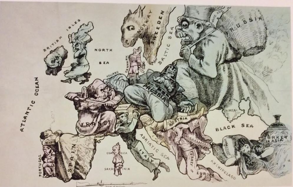
The display continues to generate important conversations among students as well as between students and library staff.
Here's a story about this exhibit: The world according to ... whom? Mapping stereotypes which appears in the March issue of Open Shelf, the online magazine of the Ontario Library association.
.jpg)

Thanks for sharing this! :-D
ReplyDeleteYou're welcome!
Delete